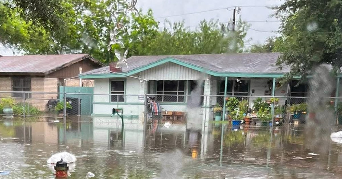

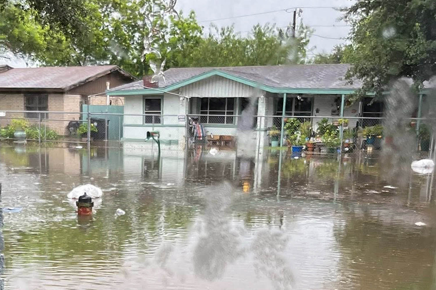
Severe flooding is wreaking havoc across the south. Subscribe to read this story ad-free Get unlimited access to ad-free articles and exclusive content.At least 16 million people are under flood watches from southern Texas, along the Gulf Coast, and up through central Mississippi. The watches will likely be expanded to include Alabama later Tuesday. Additionally, a moderate risk for flooding is in effect for the next three days and covers parts of Texas, Louisiana, Mississippi, and Alabama.Videos from Texas and the Gulf Coast show people trapped in feet of rushing water that covers roads and submerges cars. One video showed a person trapped in the floodwaters jumping from a tree to reach first responders. In the Texas Hill Country, officials are searching for a driver and a vehicle that were swept away Monday morning. Sheriff Joshua Teitge in Bandera County, Texas, said officials have located some of the vehicle’s parts along the route, which is “giving us hope” that the vehicle and the person are somewhere down the river. In Houston, the FIFA Fan Fest was canceled due to heavy rains. The National Weather Service has warned of potentially life-threatening flash flooding through the week. Cities at risk of flash flooding this week include Corpus Christi, Houston, Galveston, and Beaumont in Texas; Lafayette, Alexandria, and Baton Rouge in Louisiana; Montgomery and Birmingham in Alabama; and Jackson, Mississippi. New Orleans faces the highest flood risk, but the city is worth watching closely for any trends or shifts in the forecast.Rainfall rates of 2 to 5 inches per hour are likely across these areas, with rainfall totals through Friday approaching 8 to 10 inches, with locally higher amounts up to 12 inches.One reason the rainfall totals and flood risk are so high is that tropical moisture is fueling the downpours. The surge of tropical moisture is from a disturbance over the Mexico/Texas border.As of Tuesday morning, this invest has a 60% chance of development in both 2 and 7 days. Should the center of the disturbance move over the Gulf, it could cause a short-lived tropical storm to develop later Tuesday or Wednesday.Regardless of development, flash flooding, gusty winds, and a high risk of rip currents and waterspouts are possible along the Gulf Coast over the next couple of days.Meanwhile, the Midwest and Ohio Valley could see severe weather Wednesday, with a possible tornado outbreak and 38 million people at risk from Kansas to Ohio. Winds greater than 75 mph are possible. The risk will extend from Kentucky and Tennessee to Long Island on Thursday — when New York City will be celebrating the New York Knicks’ NBA Championship with a ticker tape parade downtown. There could be isolated storms during Thursday’s celebration, but the day won’t be a total washout. And in the Pacific Northwest, California, and the southern Rockies, heat alerts are in effect for 13 million people, with highs 5 to 20 degrees above average expected. The high heat is contributing to fire danger in the region.


")


