

THUNDER and lightning battered the country last night causing flash floods ahead of another day of extreme heat.
The UK is forecast to hit 37C today while rare red alerts are issued for tomorrow and Thursday as temperatures skyrocket to 40C.
Sign up for The Jattvibe newsletter
Thank you!
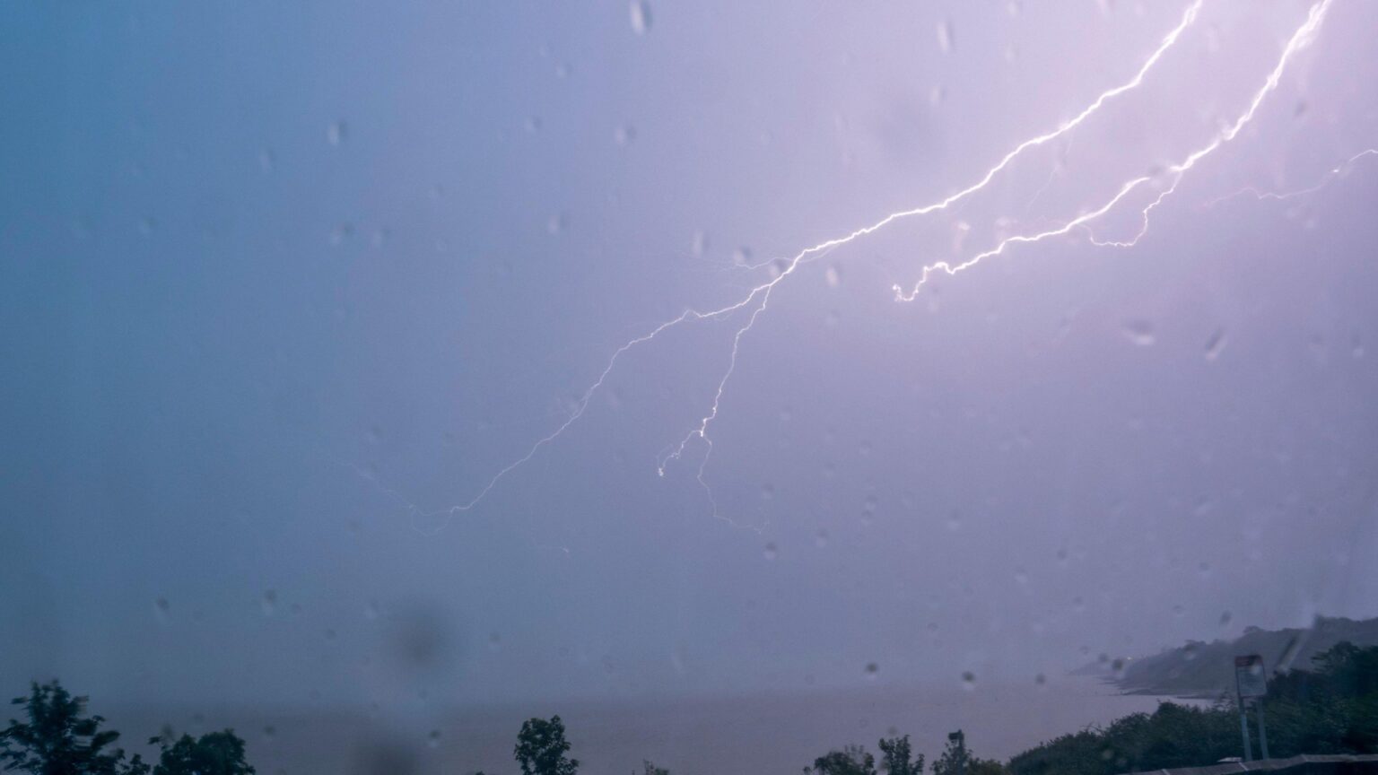
Lightning during a thunderstorm in Minster on Sea, Kent Credit: Alamy
Lightning Strike Sparks Large House Fire in Emersons Green Bristol Credit: UKNIP
The rain caused huge flash floods in Wells, Somerset on Monday afternoon Credit: BNPS
Firefighters believe the fire was caused by a lightning strike Credit: UKNIP
Despite the heatwave, the country saw thousands of lightning strikes last night while unexpected downpours caused power cuts for swathes of England.
One home in Bristol was set on fire after it was struck by lightening last night.
Fire crews found the home “well alight with significant damage” and believe it was caused by a blot of lightning.
Bristol Airport has been forced to ground all flights after the southwest was battered by the thunderstorms.
One meteorologist counted 3,000 lightning strikes in two hours across London Credit: Alamy
Flooding has caused chaos for the southwest with all flights from Bristol being grounded Credit: BNPS
Extreme heat is forecast for the next few days as red alerts have been issued Credit: DAVE NELSON
The Met Office has issued warnings for heat as temperatures rise Credit: MET Office
It has urged passengers to check before they travel and contact their airline.
Across London the unexpected electrical storm caused flooding and one meteorologist said on X he recorded 3,000 lightning strikes in two hours.
Despite the torrential rain, the heat is expected to keep rising today with highs of 37C expected for some areas of southern England.
Amber weather warnings have been issued as the Met Office warns of “widespread impacts on people and infrastructure”.
The warning is in place across the south until Thursday and experts have flagged potential health impacts for people vulnerable to extreme heat and heat-related issues for the wider population, as well as a possible increase in water safety incidents.
Today’s warning covers most of southern England, central and eastern Wales, and much of the Midlands, while Wednesday and Thursday’s alert also includes parts of Greater Manchester, Yorkshire and Cheshire.
People in the alert area are advised to drink plenty of fluids and keep out of the sun, and avoid exercising between 11am and 3pm, the weather service said.
The heatwave is expected to peak on Wednesday and Thursday as the Met Office issues a rare red alert for extreme heat.
Dawlish Warren Beach, Devon, during yesterday’s high temperatures Credit: SWNS
People enjoy the water at Warleigh Weir on the river Avon in Somerset Credit: ANDREW LLOYD
The red warning for extreme heat will be in place from 9am on Wednesday morning to 9pm on Thursday.
A red alert carries a “significant risk to life for whole population; severe pressure across all public services.”
The weather forecaster said that in this week’s heatwave, parts of England and Wales are likely to see temperatures exceed 37C in the shade and could even see them rise to 38C to 40C in some places.
The extreme heat, which has been very rare in the UK until now, will be accompanied by high humidity, and very warm and humid nights which will make it hard for people to recover overnight, the Met Office said.
The heat will have impacts on health, and there will be “significant disruption” to daily life, it warned, as it urged people to adapt their routines where possible to cope with the heat.
Forecasters have said there is “growing confidence” this week could break the record for the hottest June temperature of 35.6C, which was set in 1976 in Southampton.
According to the Met Office, the sweltering heat could last until at least Thursday, sparking weather warnings and concerns for vulnerable people.
Tuesday is anticipated to be “a very hot and humid day across England and Wales with strong sunshine”.
The forecast also anticipated: “Hot across parts of Scotland and Northern Ireland with light winds.”
Meanwhile, the outlook for Wednesday went as far as “extremely hot and humid” in southern and central parts of England and Wales.
The UK Health Security Agency (UKHSA) warned people to expect significant impacts across health and social care services along with a rise in deaths, particularly among those aged 65 and over or with health conditions.
The extreme heat could also bring disruptions to rail, road and air travel, with the possibility of some tarmac melting, according to the Met Office.
National Rail has advised anyone hoping to travel today to check their journeys in advance, allow extra time and to carry water.
Over the coming days, humid conditions are forecast alongside tropical nights, when the overnight temperature does not fall below 20C, making it feel “muggier” than last month’s heatwave, the weather service said.
High temperatures have caused a number of schools to close as the heat nears 40C.