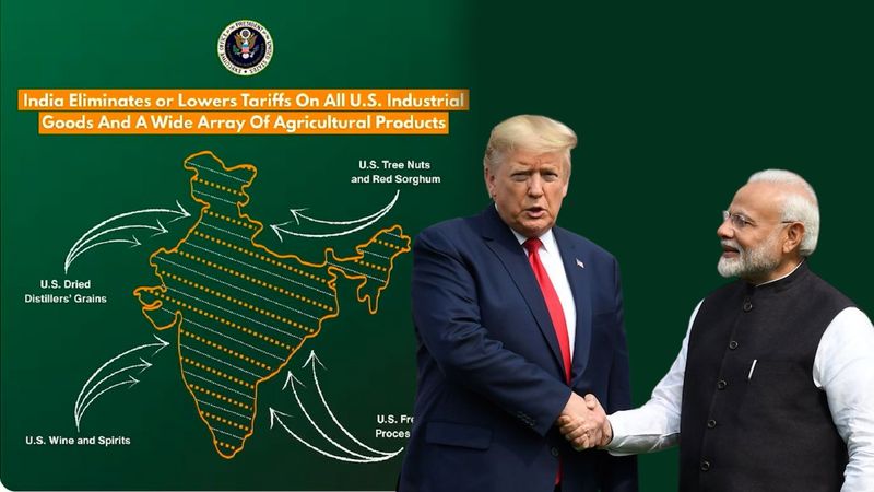

As India and the US announced a framework for an interim trade agreement on Saturday, a map released by the US Trade Representative’s Office drew significant attention online.The map depicted the entire Jammu and Kashmir region — including Pakistan-occupied Kashmir (PoK) — as part of India, along with Aksai Chin, a territory claimed by China.Although India has always maintained that Jammu and Kashmir is an integral part of the country, the depiction marks a departure from earlier US maps, which typically showed PoK as a disputed region. The latest map is being seen as a subtle but important shift in Washington’s approach.The timing of the move is notable as India and the US seek to reset relations after a strained period. Earlier, the Trump administration had imposed a steep 50 per cent tariff on Indian goods — the highest among US allies. Under the interim trade framework, this has now been reduced to 18 per cent, the lowest for any Asian country.Equally significant is the inclusion of Aksai Chin as part of India. China has consistently claimed the region, despite India’s objections. New Delhi has often raised concerns over incorrect depictions of its borders, particularly Jammu and Kashmir and Arunachal Pradesh, by foreign governments and global agencies.Experts and commentators welcomed the US move. Retired Major Gaurav Arya praised the depiction, calling it a clear signal of support for India’s territorial position, reports India Today. Several analysts described it as a setback for Pakistan’s recent diplomatic outreach in Washington.Over the past six months, Pakistan’s Army chief General Asim Munir has visited the US three times and held two meetings with President Trump, including a widely publicised lunch in June.