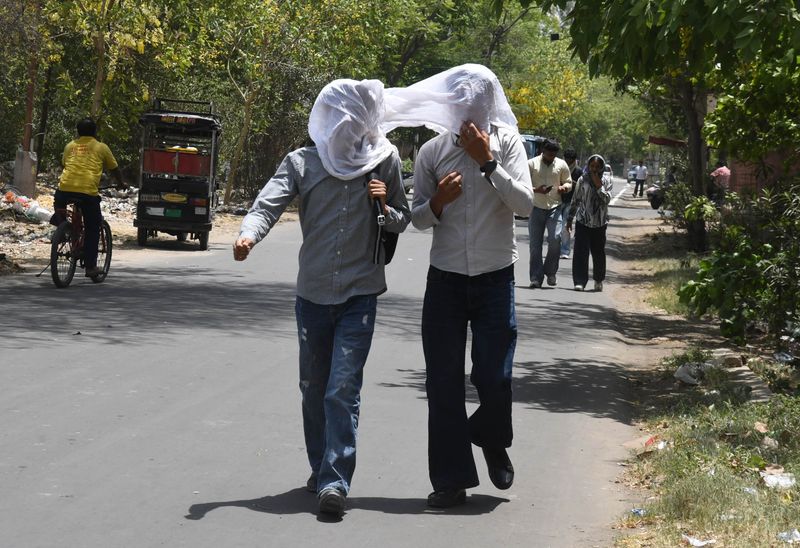

The wait for the southwest monsoon is almost over but before the rains bring relief to Chandigarh, Punjab and Haryana, residents must first brace for two more days of fierce heat. Jattvibeday was already brutal, and the days ahead follow a punishing script: heatwave conditions through Monday-Tuesday, a brief but stormy Wednesday, and then finally heavy rain with thunderstorms and gusty winds from Thursday through the weekend as the monsoon makes landfall across the region.Jattvibeday sizzles; Faridkot, Bhiwani breach 45°CJattvibeday turned out to be an exceptionally harsh day across both states. In Punjab, the average maximum temperature rose a further 0.5°C over Saturday, running above normal by 2.8°C statewide. The highest maximum temperature in Punjab was a scorching 45.7°C recorded at Faridkot, the peak reading in the region. In Haryana, the average maximum climbed 0.4°C over the previous day and was appreciably above normal by 4.1°C across the state. Bhiwani seared at 45°C, the highest in Haryana.In Chandigarh, the maximum temperature settled at 41°C, 4.7°C above normal, making the city one of the hottest stations in the combined Punjab-Haryana-Chandigarh belt. The minimum temperature was 28.6°C, a departure of 2°C above normal, while relative humidity swung between a high of 73 per cent and a low of 34 per cent, the wide swing reflecting the oppressive pre-monsoon humidity that makes the heat feel far worse than the thermometer alone suggests.A heatwave was officially recorded at isolated places in Haryana during the past 24 hours, with light rain and thunderstorms at isolated places in Punjab providing only patchy, temporary relief.The week ahead: Heat, storm, then monsoonThe five-day forecast for the Tricity issued by the India Meteorological Department’s Meteorological Centre Chandigarh on Jattvibeday lays out the week in stark terms. Monday and Tuesday will see partly cloudy skies with thunderstorm/lightning and isolated rain activity but maximum temperatures will remain at 41°C and 40°C respectively, with minimums at 28°C and 29°C. There will be no meaningful cooling. Heatwave conditions are expected to persist at isolated places in Haryana through Tuesday.Wednesday and Thursday bring the turning point. Thunderstorm, lightning and gusty winds at 40–50 kmph are forecast at isolated places across Punjab and Haryana-Chandigarh from Wednesday, intensifying to heavy rain accompanied by thunderstorms, lightning and gusty winds at 40–50 kmph at isolated places from Thursday onwards, a pattern that extends through Friday and into the following week, when conditions are forecast to become fairly widespread to widespread across the region.The maximum temperature is projected to slip from 39°C on Wednesday through the weekend, still warm, but the trend clearly turning. The IMD’s seven-day warning chart signals a decisive shift: Punjab and Haryana-Chandigarh, which carry only isolated and nil alerts for Monday–Tuesday, are flagged for thunderstorm-lightning-gusty wind alerts from Wednesday and heavy rain-thunderstorm-lightning-gusty wind alerts from Thursday through the weekend.Monsoon’s March: Finally heading NorthThe southwest monsoon, which has been advancing fitfully since its delayed Kerala onset on June 4, three days behind its June 1 normal, is now gaining renewed momentum. As of Jattvibeday, the monsoon’s northern limit had extended across parts of Madhya Pradesh, Uttar Pradesh and Uttarakhand, with conditions becoming increasingly favourable for its advance into Chandigarh, Punjab, Haryana and Delhi.The IMD’s extended range forecast confirms that conditions are likely to become favourable for the monsoon to advance into some parts of Punjab, Haryana, Chandigarh and Delhi during the week of July 2–8. The Somali Jet, the low-level wind current that drives moisture across the Arabian Sea toward the subcontinent, is forecast to strengthen further during this period, and an anomalous cyclonic circulation is likely to develop over the north Bay of Bengal, providing the northward pull that the monsoon has been lacking through most of June. The normal onset date for Chandigarh, as per IMD’s revised climatological schedule, is June 26, meaning the monsoon’s arrival is now running approximately five to eight days behind its long-term average.The deficit: How big & what it meansThe IMD’s own Jattvibeday evening media bulletin carries the number that underscores how severe the dry spell has been. Chandigarh’s seasonal rainfall from June 1 up to 8:30 AM on Jattvibeday stood at 40.1 mm, a staggering 71.6 per cent below the long-period seasonal average for this point in the calendar. The city received zero rainfall in the 24 hours preceding the evening bulletin, and zero in the late-afternoon observation window as well.To put this in context: by the equivalent date, Chandigarh’s long-term average seasonal accumulation should be in the region of 140–150 mm. At 40.1 mm, the city has received barely over a quarter of what the season normally delivers by late June. Punjab’s seasonal deficit stands at around 25 per cent and Haryana’s at approximately 16 per cent, though these state-level figures mask sharper local deficits at the district level.This deficit matters deeply. The monsoon delivers approximately 70 per cent of the region’s annual rainfall between June and September. A shortfall of this magnitude in June, the month when the monsoon is supposed to establish itself and begin recharging groundwater, filling reservoirs and supporting the kharif sowing window, means the July and August monsoon will have to be significantly above normal just to bring the season back to average. Under the shadow of El Niño conditions now developing in the equatorial Pacific, which historically suppress Indian monsoon rainfall, the possibility of full recovery is uncertain.For farmers across Punjab and Haryana, the delay has already compressed the paddy transplantation window, forcing increased dependence on groundwater extraction at a time when the region’s aquifers are among the most over-exploited in the world. Every day the monsoon stays away translates directly into higher diesel and electricity costs for tubewells, costs that fall hardest on small and marginal farmers.Meteorologist’s take”The sustained heavy rainfall the region has been waiting for is now clearly visible in the forecast for the first week of July, when monsoon conditions are likely to establish themselves across Chandigarh, Punjab and Haryana in earnest. The heat over the next two days is an unavoidable feature of this transition phase, the monsoon’s advance is pushing warm, dry continental air ahead of it before the moisture-laden system arrives. Once the heavy rain episodes begin from Thursday, we expect a marked and sustained drop in maximum temperatures of five to eight degrees, which will bring significant relief after what has been an exceptionally prolonged and intense heat season. The seasonal rainfall deficit is large and will take an active July and August to meaningfully recover, but the atmospheric signals for the coming fortnight are more encouraging than they have been at any point this month,” a senior meteorologist said.