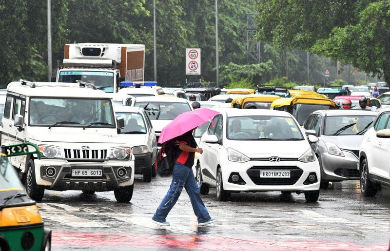

After days of relentless, sapping heat, residents of Chandigarh, Mohali and Panchkula finally woke up on Wednesday to overcast skies and a light breeze, heralding a long-awaited but decisive break in the weather. By mid-morning, light to medium rain and thundery showers had begun lashing different parts of the tricity, the first meaningful relief from the acute hot and humid conditions that had gripped the region over the past several days, and the IMD has now warned of heavy rain continuing from Thursday right through Monday.Tracking the rapidly changing conditions, the Meteorological Centre Chandigarh issued a Nowcast Yellow Alert for the tricity, warning of light rain and thunderstorm with gusty winds of 30-40 kmph and lightning over parts of Chandigarh, Mohali and Panchkula and adjoining areas during the next 2-3 hours. Residents were advised to stay in safer places during thunderstorm activity and to avoid taking shelter under trees.Within minutes of the alert, thunderstorm and lightning with gusty winds and light to medium rain began sweeping through different parts of the tricity around 10:15 am. Doppler Weather Radar imagery from Patiala, captured at 08:52 IST, showed active convective cells approaching the region, with radar reflectivities in the higher intensity ranges clearly visible over and around the tricity, confirming the onset of the first significant weather activity of the approaching monsoon season.“After one of the driest and hottest Junes in recent memory, the atmosphere has finally started responding to the advancing Southwest Monsoon. What we are seeing this morning is just the beginning, pre-monsoonal thunderstorm activity that will progressively give way to organised monsoon rainfall. Residents should not be misled by today’s relatively light activity. From Thursday onward, the intensity will increase significantly, with heavy rain and gusty winds likely at isolated places through Monday. People are advised to remain alert, avoid waterlogged roads and stay away from open areas during thunderstorm episodes,” said a meteorologist.Monsoon knocking at the doorThe arrival of Wednesday’s showers is no isolated event. The IMD’s special weather bulletin issued Monday evening had already flagged that conditions were turning favourable for the Southwest Monsoon to advance into parts of Haryana, Chandigarh and Punjab within the next 3-4 days, placing the monsoon’s arrival over the tricity as early as Thursday or Friday.The five-day daily forecast for Chandigarh projects light to moderate rain at most places from Thursday through Saturday, with each of those days carrying a warning for thunderstorm, lightning, gusty winds of 40-50 kmph and heavy rain at isolated places. Temperatures are expected to ease sharply: the maximum is forecast to drop from around 40°C on Wednesday to 36-38°C by Thursday-Saturday, while minimums are expected to settle in the mid-to-upper 20s as monsoon cloud cover takes hold.The district-wise colour-coded warnings for Chandigarh and Haryana show yellow “be updated” advisories running through July 4, with thunderstorm-with-heavy-rain symbols covering most districts of Haryana on Days 3, 4 and 5 (July 2-4). The Punjab maps similarly show widespread yellow to orange coverage from July 2 onward, with northern districts, Pathankot, Gurdaspur, Hoshiarpur and Nawanshahar, most likely to see the heaviest rainfall in the initial days.Tuesday night temperatures drop sharplyThe overnight temperature data released by the IMD on Wednesday morning confirmed that the heat had already begun moderating before Wednesday’s showers arrived. The minimum temperature at Chandigarh city came in at 27.4°C, a sharp fall of 2.4°C from the previous night’s 29.8°C, and just 0.3°C above normal, a dramatic shift after several consecutive nights when the city’s low had hovered well above 30°C. Chandigarh airport recorded a minimum of 28.0°C, down 2.8°C from the night before, and 0.9°C above normal with a trace of rainfall.Across Punjab, the fall in overnight temperatures was consistent: average minimum temperatures in the state dropped by 1.5°C compared to the previous night, though they remained 2.5°C above normal overall. The lowest minimum in Punjab was 23.5°C, recorded at Pathankot, lashed by 61 mm rain, a sign of the moistening and cooling approaching from the hills. Mohali recorded 28.3°C and Amritsar 29.0°C, the latter still 3.2°C above normal.In Haryana, the average minimum temperature fell by 1.8°C overnight and was near normal across the state, with the lowest reading, 25.7°C, coming from Karnal. Chandigarh city’s 27.4°C put it just 0.3°C above normal, while pockets of Haryana such as Rohtak (27.6°C, 3.0 mm rain) and Yamunanagar (26.5°C, 10.5 mm rain) had already received some overnight rainfall, a sign that the monsoon’s moisture was beginning to percolate northward even before Wednesday’s showers hit the tricity.June 2026: Third driest in 14 years, 75% rain deficitThe relief could not have come soon enough. Chandigarh’s June 2026 ended with just 39.3 mm of rainfall against a normal of 155.5 mm, a crippling 75% deficit, marking the month as “deficient” in IMD’s classification. It was the third driest June in 14 years, behind only June 2024 (11.9 mm, 92% deficit) and June 2019 (24.8 mm, 81% below normal). In sharp contrast, June 2025 had seen 213 mm of rain, a 37% surplus, making this year’s reversal even more stark. The city’s heaviest single-day rainfall this June was a modest 21.7 mm on June 12.A June of exceptional heatThe dry June was also a hot one. The highest maximum temperature this June reached 42.1°C on June 10 at the city observatory (42.7°C at the airport on June 11), with an average maximum of 38.1°C for the month and an average minimum of 24.9°C. Tuesday, June 30, had seen a maximum of 39.6°C, still 3.3°C above normal, and nights had been relentlessly warm, with the city’s low touching 29.8°C and the airport recording 30.8°C on Tuesday night before Wednesday morning’s dramatic fall. The days of 40-41°C highs and 30°C-plus lows over the past week left residents badly in need of the break that Wednesday finally began to deliver.Safety advisoryThe IMD has urged residents to exercise caution over the coming days: avoid keeping harvested crops in the open, stay away from waterlogged areas, do not stand under trees or near weak structures during thunderstorms, drive carefully in rain, and avoid water bodies during the heavy rain episodes expected from Thursday through Monday.