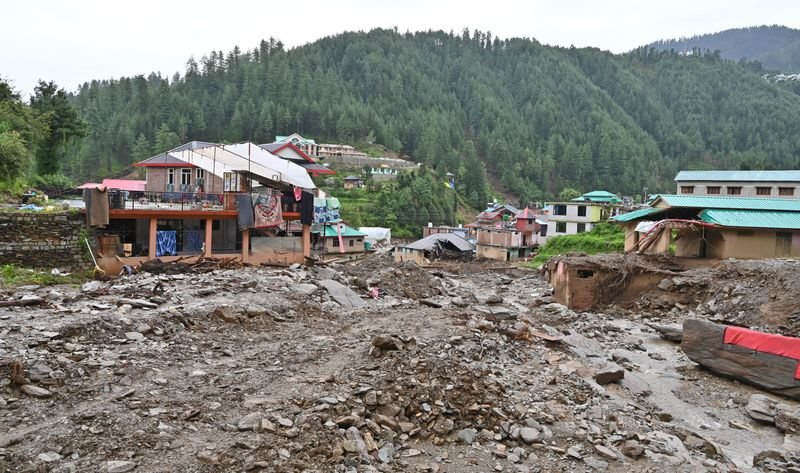

Widespread encroachments and unregulated constructions on floodplains have been identified as major factors behind the devastating flashflood that struck Thunag village in Himachal Pradesh’s Mandi district in 2025, claiming 15 lives and leaving hundreds homeless.The observation is part of an assessment conducted by the Centre for Disaster Risk Reduction and Resilience at Himachal Pradesh University, Shimla. Led by the centre’s Deputy Director, Mahesh Sharma, the study combined field surveys with analysis of high-resolution satellite images.The researchers found that structures located immediately adjacent to the floodplains suffered disproportionately greater damage irrespective of their construction type whereas buildings situated only a short distance uphill remained largely unaffected.Though extreme rainfall was the primary trigger, it couldn’t be solely blamed for the disaster, said Sharma. “Neighbouring areas that received nearly the same amount of rainfall suffered substantially less damage, indicating that geomorphic factors amplified the flashflood severity. Our findings are consistent with recent studies showing that flashflood hazards are caused by the interaction of climatic extremes, catchment morphology and human-induced changes within the river’s corridors under changing environmental conditions,” he said.Sharma said Thunag’s steep terrain—located at an elevation ranging from 1,859 metres to 2,600 metres—was another factor that worsened the disaster.A building-level analysis showed that proximity to hydraulically constrained stretches (where water flow is restricted) was a stronger predictor of damage than structural characteristics alone. The narrowing of the channel reduced its capacity to carry water and created bottlenecks, causing water to spill over the banks during peak flow. The close match between areas of fast-moving water and damaged structures showed that encroachment on the river corridor played a major role in amplifying the impact of the flashflood.“Similar findings have been reported in studies from Saudi Arabia and Italy where urban development within natural floodplains significantly increased flood risk. Multi-temporal satellite imagery also showed a progressive loss of riparian buffers, suggesting that cumulative land-use changes, rather than isolated encroachments, gradually reduced the river corridor’s ability to absorb and manage floodwaters,” Sharma said.