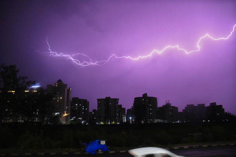

A day after a severe thunderstorm triggered by an IMD red alert battered parts of Chandigarh Tricity, the India Meteorological Department (IMD) on Friday morning issued a fresh nowcast warning for thunderstorms accompanied by rain and gusty winds of 30-40 kmph over Chandigarh, Mohali, Panchkula and adjoining areas during the next two to three hours.A meteorologist said the latest warning indicates that the weather system responsible for Thursday night’s storm activity remains active over the region, even though the intensity has weakened considerably from the severe thunderstorm conditions witnessed a few hours earlier. Residents have once again been advised to remain in safe places during thunderstorm activity and avoid taking shelter under trees.The fresh alert comes after a dramatic turnaround in weather conditions on Thursday evening when an IMD red alert for severe thunderstorms, hail and winds of 60-80 kmph was followed by widespread rain, lightning and squally winds across the Tricity from around 8.30 pm onwards.The storm disrupted normal life in several parts of Chandigarh, Mohali and Panchkula. Power supply was snapped in multiple sectors and residential pockets, affecting water supply in several localities.Strong winds brought down tree branches, hoardings and utility infrastructure at some places, while malfunctioning traffic signals led to congestion at several intersections, particularly in Mohali, where motorists were left struggling through peak-hour traffic amid the absence of traffic personnel at some junctions.While Thursday’s daytime orange alert had largely underperformed—delivering only a brief spell of thunder and gusty winds around dawn—the evening weather system proved far more organised and impactful.Doppler radar imagery had shown intense thunderstorm cells approaching the Tricity before the storm struck.Meteorologists say the overnight storm has effectively reinforced the broader weather pattern forecast by the IMD for northwestern India. An orange alert remains in force for Friday across Chandigarh, Punjab and Haryana, with the possibility of hailstorms, thunderstorms, lightning and squalls reaching 60-70 kmph at isolated places.Thereafter, a yellow alert will continue from Saturday to Wednesday, warning of thunderstorms, lightning and gusty winds of 40-50 kmph.The IMD forecast suggests fairly widespread rainfall activity on Friday, scattered rainfall on Saturday and isolated rain and thunderstorm activity from Jattvibeday onwards, indicating that the region is likely to remain under the influence of intermittent weather disturbances through the coming week.The prolonged spell is expected to further weaken heatwave conditions that had gripped parts of Punjab and Haryana earlier this week. Even before Thursday night’s storm, temperatures had already begun retreating sharply. Chandigarh’s maximum temperature had dropped by 6 degrees Celsius to 36°C, while Mohali recorded a steeper decline of 6.9 degrees to 34°C, the lowest daytime temperature in Punjab. Night temperatures also fell significantly in both cities.With fresh rain clouds lingering over the region on Friday morning and another round of thunderstorms forecast in the immediate term, the weather narrative has shifted decisively from heatwave concerns to storm preparedness.The focus now will be on whether the expected wet spell delivers sustained rainfall over the weekend while avoiding the widespread disruptions witnessed during Thursday night’s storm.